
Dual Maps 3D
Dual Maps 3D synchronises two map views side by side — a 2D road/satellite map and a photorealistic 3D map - plus street-level photography all locked to the same location simultaneously.
How Dual Maps Evolved
Dual Maps was created in 2008 by Map Channels and first appeared at mapchannels.com/DualMaps.aspx.
Dual Maps was featured in the Google Maps API Blog and in the Google Maps Mania Blog.
Dual Maps was originally built around Google's 45° birds-eye imagery — the oblique aerial view that let you see buildings and terrain with real depth. In 2026 Google stopped providing that view entirely so only the satellite view was then available.
Rather than simply patching the gap, the project was rebuilt from scratch to take advantage of something far more powerful: CesiumJS rendering Google Photorealistic 3D Tiles — the same high-fidelity building geometry and terrain previously only available in Google Earth — directly inside a web page. The result is Dual Maps 3D, where a standard road map and Google Street View now share the screen with a live, tiltable, orbitable 3D Earth powered by Google's Map Tiles API.
Alongside this, Dual Free Maps was developed as a fully open-source alternative using MapLibre GL, OpenStreetMap, ESRI satellite imagery, and Mapillary street-level photography — no API keys required.
17 June 2026 : Street View driver mode
There is now an arrow icon in the header bar of Dual Maps 3D. Click this arrow to start the Street View driver mode and explore the area.
Point the street view in the direction that you want to travel and view the animated journey.
Driver mode lasts up to 15 minutes or until no route can be found.
From flat road maps to photorealistic 3D — all synchronised, all in one window.
Available Maps

🌍 Dual Maps 3D
Road map, Google Street View, and full photorealistic 3D Earth — synchronised in real time. Tilt, orbit, and explore any location on the planet from the ground up to a bird's-eye 3D perspective.
- Google Maps 3D (Map3DElement)
- Street View with heading sync
- Orbit animation & camera control
- Address search
- Street View driver mode
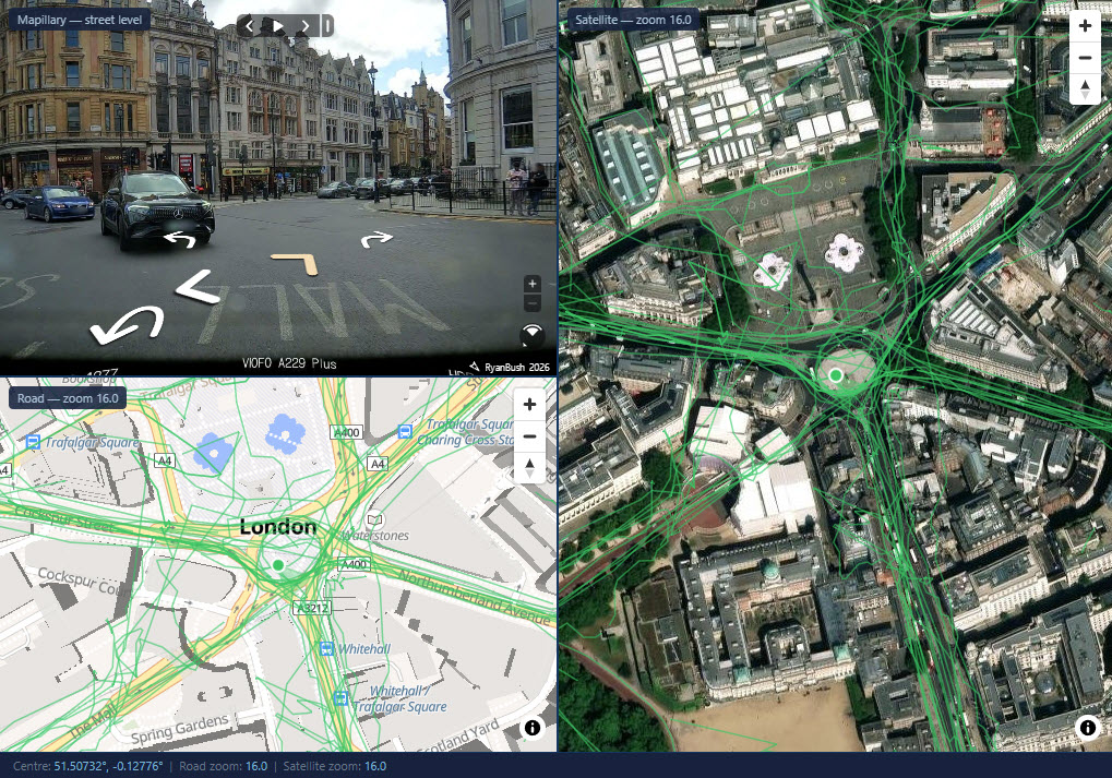
🧭 Dual Free Maps
A fully open-source dual map using MapLibre GL with OpenStreetMap road tiles, ESRI satellite imagery, and Mapillary street-level photography. No Google API key required.
- MapLibre GL · OpenStreetMap · ESRI
- Mapillary street-level imagery
- Multiple road map styles
- No API key required
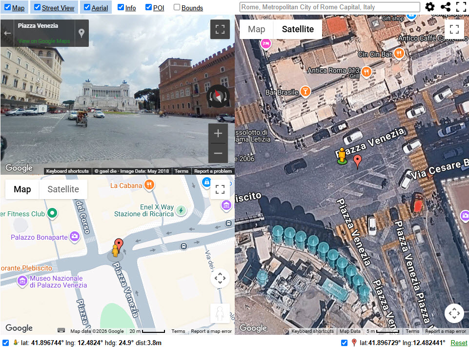
🗺 Dual Maps 9
The original Dual Maps combining Google Road, Birds Eye aerial imagery, and Street View. The 45° birds-eye mode has been deprecated by Google — preserved here for reference and legacy use.
- Google Maps road view
- Google Street View
- 45° birds-eye (deprecated by Google)
- Hosted at mapchannels.com